By leveraging combination of SAR and optical systems, stakeholders can effectively
monitor the environment, expand their businesses, and advance toward sustainable
development goals.
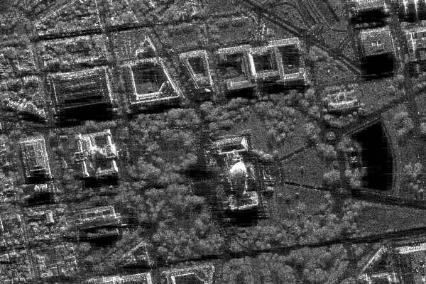
Urban Monitoring |
|
|---|---|
|
• The AIRSAT constellation system offers high-resolution data to track urban growth accurately. • This monitoring provides insights into urbanization pace, aiding in informed infrastructure planning. • Frequent SAR satellite revisits allow timely monitoring, enabling authorities to prioritize maintenance and uphold public safety. |
|
Disaster Monitoring |
|
|---|---|
|
• AIRSAT's all-weather monitoring capability with high-resolution SAR imagery is crucial for quickly assessing post-disaster damage. • It transcends cloud cover barriers, providing detailed insights into affected areas. • This real-time data empowers authorities for prompt decision-making in emergency response and proactive disaster mitigation efforts. |
|
Precision Farming |
|
|---|---|
|
• AIRSAR's data enhances agricultural monitoring by providing detailed insights into crop characteristics, soil conditions, and land management practices. • Its fine-scale information across different polarization states makes it valuable for precision agriculture and sustainable land use management. |
|
Border and Security Monitoring |
|
|---|---|
|
• AIRSAR data constellation is vital for border and security monitoring, providing timely intelligence for enforcement and security agencies. • Its versatility and wide coverage make it indispensable for safeguarding borders and combating threats, ensuring security and sovereignty. |
|
Land Deformation and Subsidence |
|
|---|---|
|
• SAR data plays a critical role in monitoring land deformation caused by earthquakes and land subsidence, offering valuable insights into the rate of change. • The derived information can be beneficial to stakeholder to address associated risks and challenges. |
|
Get in touch with our sales team and request quote for the product & services you are looking for.
REQUEST QUOTE